The Heritage Story Map of Galway City
Heritage StoryMap Galway City
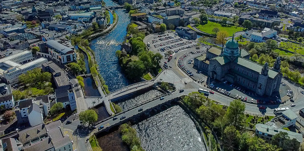
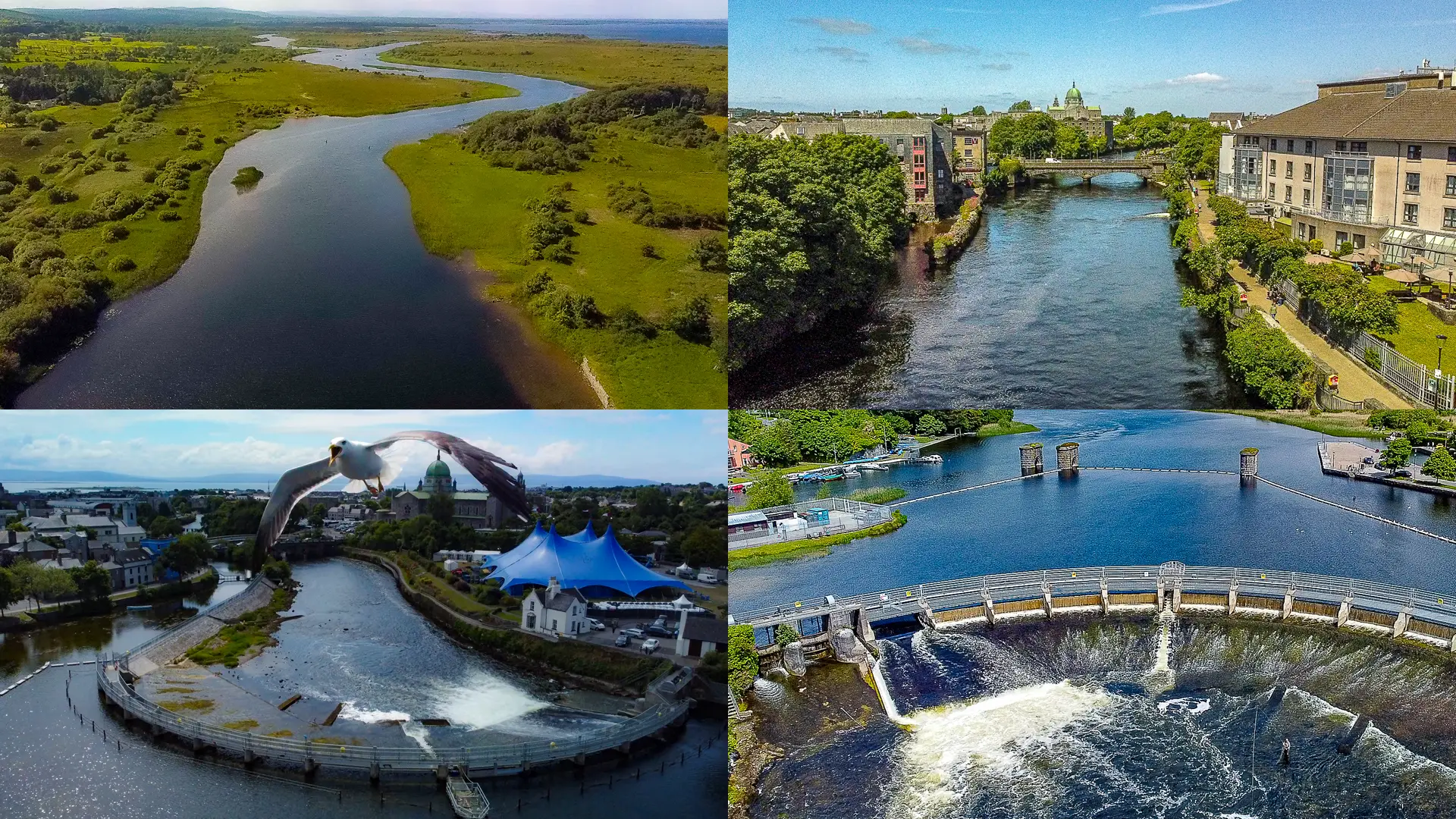
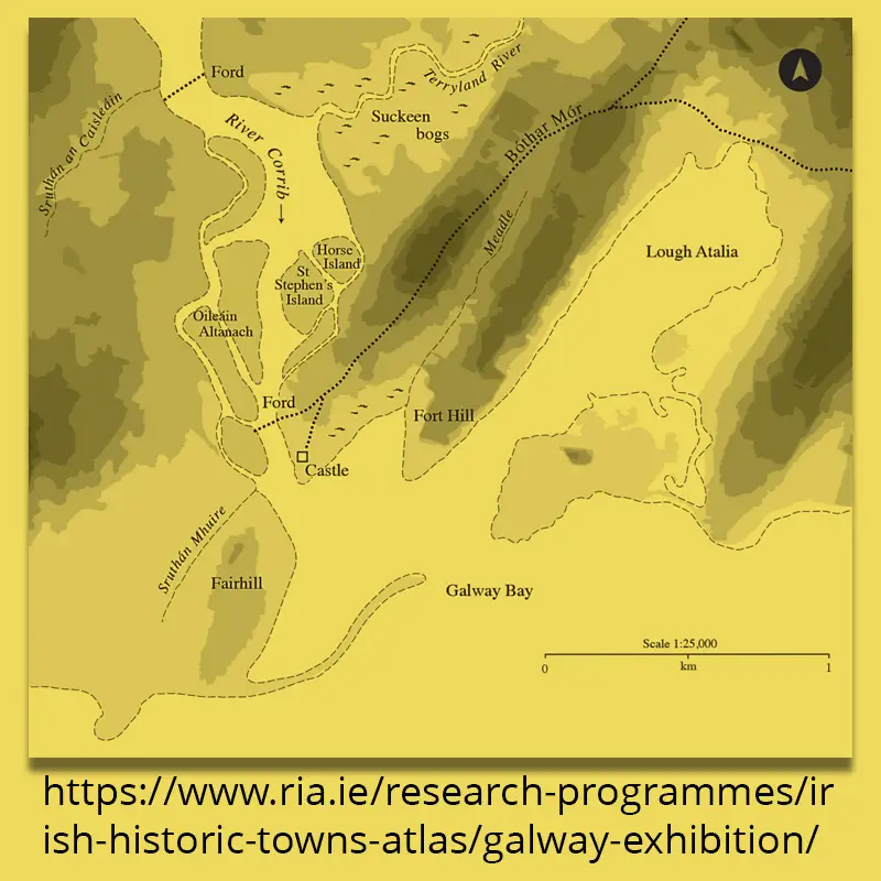
Galway City is known as “Baile na Sruthán” (the City of Streams), historically a network of streams and islands fed by the River Corrib, shaping its culture, economy, and geography.
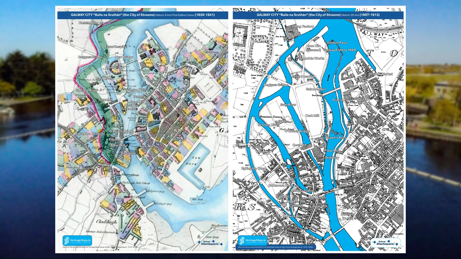
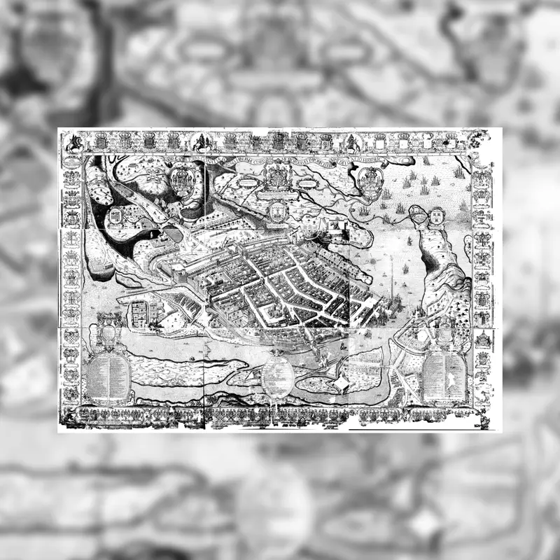
Whilst watching the Heritage Maps Viewer, users can scroll or swipe left or right to see the changes to Galway City over the last two hundred years.
With the addition of the Historic 6 Inch First Edition Colour (1829-1841) and Historic 25 inch Black & White(1897-1913) Maps we can see how the landscape, buildings and industry has changed.
Limitations. The Maps are difficult to reprint, and some text is hard to read.
With all this information at our fingertips it is a great opportunity to create a StoryMap.
A story map is a visual tool that organizes the key elements of a narrative, like characters, setting, plot (beginning, middle, end), problem, and solution.
Using interpretation and the concept of the Heritage StoryMap Galway Atlantaquaria would like to tell our story of Galway.
In the Flow of History
Mapping Galway’s Rivers and Industries Heritage Poster Project
HERITAGE MAPS
We could not have done this work without the source information from Heritage Maps, Galway Community Heritage, Galway Museum, Galway Library, Galway Advertiser, Kennys Bookshop, and Galway Waterways Foundation (GWF).
What is Heritage and why is it important?
In general terms, heritage is what we have inherited from the past, that would remain untouched, but it is much more. It is a link to our past which helps us understand our traditions and how we have evolved as society. Heritage makes the essence that brings us together as a community…..
Let’s Explore Galway City from 1829. Starting from the top of the Map.
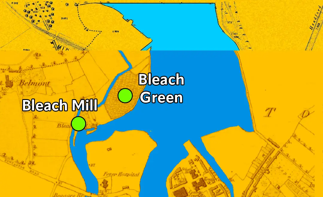
The Bleach Mill (later taken over by the bag factory), A mill for bleaching linens. On the edge of the Galway River, in Town Parks townland.
Historically, there was a bleach green and mill on Earl’s Island, situated between the River Corrib and the Eglinton Canal, which was advertised in 1851. The site was considered the “industrial heartland of Galway at the time” and was later developed for other uses, including a jute factory and eventually a university building. There is no evidence of the original mill building there today.
The lands were eventually sold, as a report in the Galway Express of July 28 1866 stated: “We are happy to learn that the directors of the Galway Bag Factory Company entered on possession of the mill site and lands for their factory at the Bleach on Monday last, and that Mr Roberts has got instructions to prepare the plans for the necessary buildings. This is an augury for success and we trust that the directors will be nobly supported by the public.”
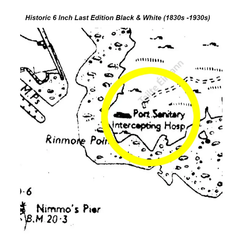
The Fever Hospital 1860 – 1900 – The hospital for the city’s poor.
Blankets were provided and the inmates were required to wear workhouse dress, which consisted of rough gray frieze suits for the men and calico gowns and petticoats for the women. There were no closets in the dormitories and the inmates had to make do with night buckets, which frequently overflowed and soiled the floors.
The Famine began to have an impact on the Galway Workhouse from mid 1846 the number of inmates progressively increased from 460 in June 1846 to 1,302 in November 1847. In December 1847 it was reported that 313 paupers were seeking admission but the Workhouse was already overcrowded. Captain Hilliard, then Assistant Poor Law Commissioner, took over a store in Newtownsmyth to accommodate between 300 and 400 children, though he appreciated that it was far from suitable. There were also auxiliary workhouses at Merchant’s Road and St. Helen’s Street, Galway and Barna.
Auxilliay Workhouses for children were established at Parkavera and Dangan in Galway and the Fever Hospital in Moycullen was converted into an Auxiliary Workhouse especially for children.
While the Workhouses offered shelter to the destitute and homeless and undoubtedly saved many from death by starvation and exposure, it must be admitted that they contributed to the death toll from epidemic diseases such as fever, dysentery and cholera.
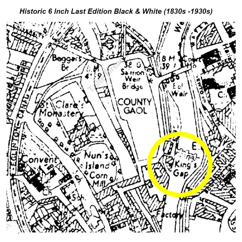
Beggars Bridge
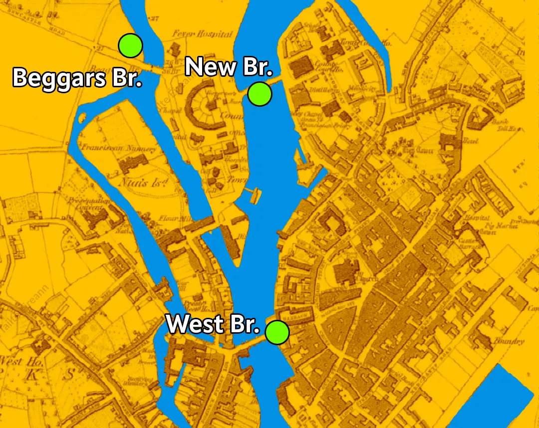
The Famine and Food Shortages, as the full extent of the crop failure became evident,the workhouse became overcrowded, the Fever Hospital on Beggar’s Bridge (which got its name from inmates begging on the bridge) was full of destitutes, and people would commit crimes to get sent to (the overcrowded) jail just so they could be fed.
The winter of 1846/47 was the most severe in living memory, and the number of deaths from hunger in the city averaged between 25 and 30 a week. Auxiliary workhouses opened in Newtownsmyth, Merchants Road, Barna and Dangan. Epidemics of cholera, typhoid fever and dysentery broke out, and by May 1847, these fevers were accounting for 100 deaths a week. During 1847 and 1848, 11,000 inmates died in Galway workhouse. On the bitterly cold morning of January 26th, 1848, two children were found naked and dead on High St., and another on an adjoining street.
A Bridge Runs Through It – The Other Bridges of Galway
O’Brien’s Bridge
The first bridge built in Galway City was O’Brien’s Bridge. The bridge that stands today is not the original structure. The original wooden bridge was constructed in 1558, but it was later rebuilt and widened in 1852. The present bridge occupies the same site as the original. In 1889, it was named in honour of William Smith O’Brien, a former Member of Parliament and a member of the Young Irelanders, a revolutionary group.
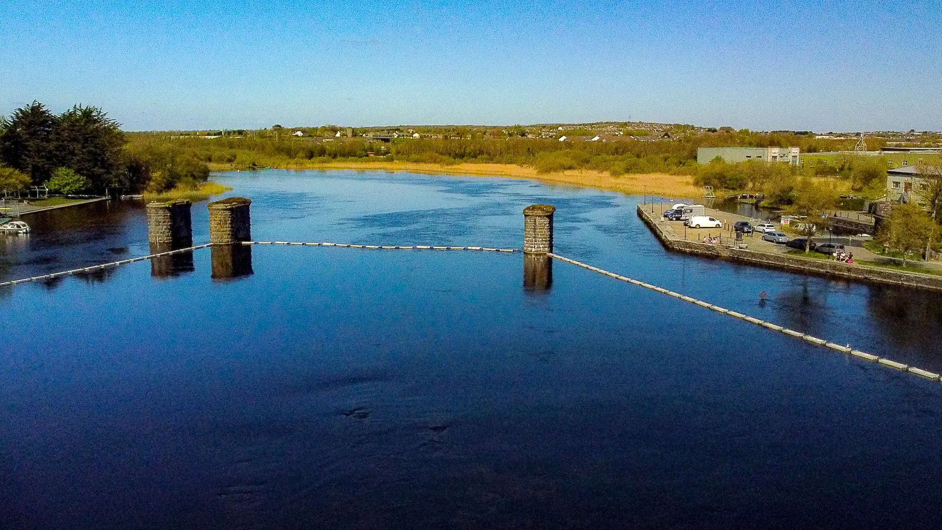
New Bridge, later The Salmon Weir Bridge 1815 – 1820
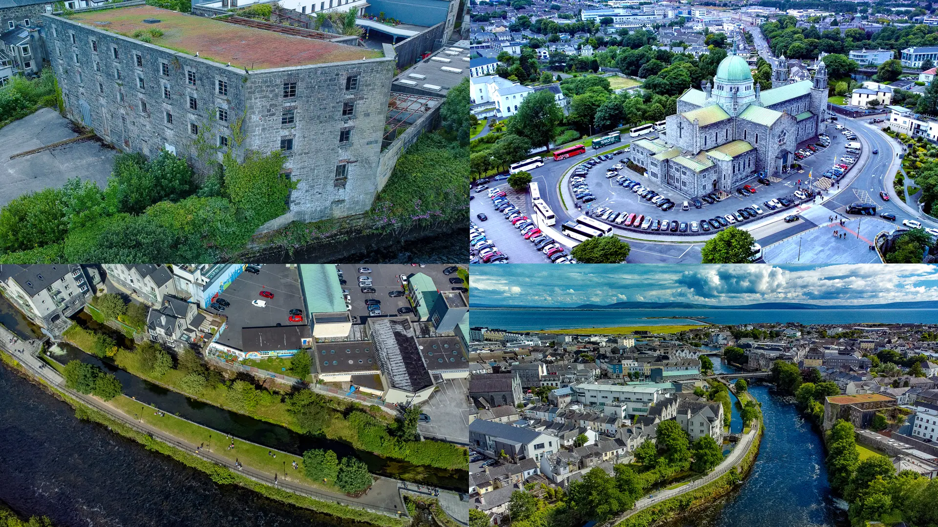
This fine bridge is an important feature of Galway’s expansive cityscape, constructed in 1818 as a means of linking the old Gaol (on the site of the present Cathedral) with the courthouse. The bridge also provides a connection with the main road to Connemara.
Note: Alice Perry Exhibit
A Galway native born in 1885, etched her name in history by becoming the first female engineer in the United Kingdom or Ireland in 1904. There is a new waterways exhibit by the Middle River that tells more of this story.
Wolf Tone Bridge
The third bridge built in Galway City was Wolfe Tone Bridge, constructed in 1887. A new bridge later replaced it in 1934. Wolfe Tone Bridge is located near the Claddagh. It is named after Theobald Wolfe Tone, one of the founding members of the United Irishmen, a republican society dedicated to ending British rule and establishing accountable government in Ireland.
Droichead an Dóchais
The opening of a new pedestrian and bicycle bridge over the River Corrib in Galway City, in front of the Cathedral, took place on 26 May 2023. Officially named Droichead an Dóchais (Bridge of Hope), it runs parallel to the current Salmon Weir Bridge.
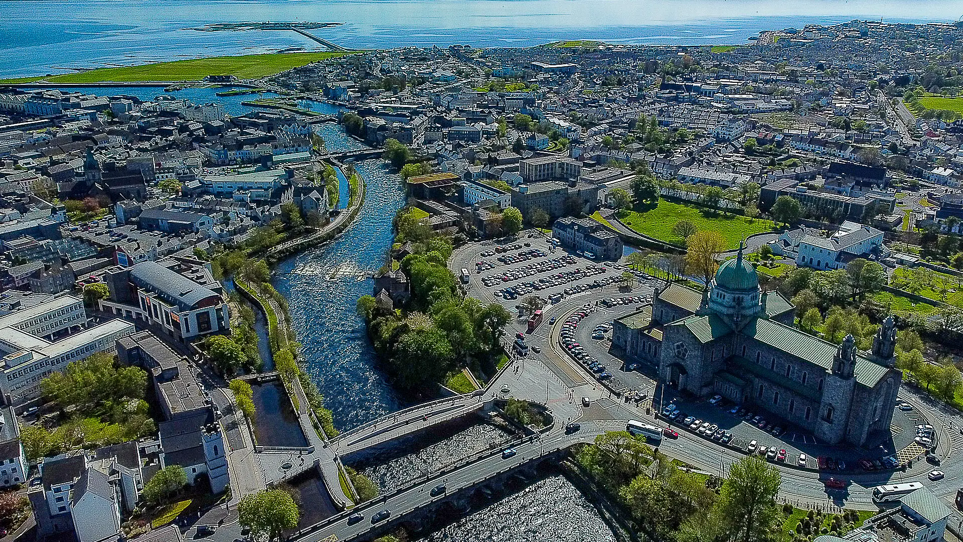
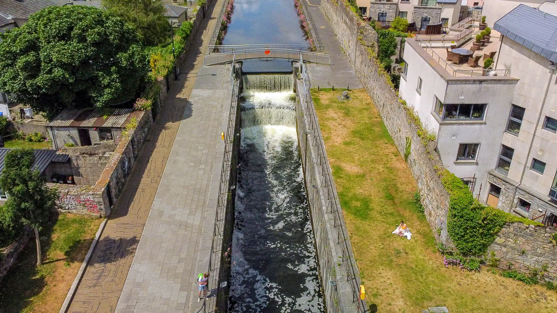
The Rivers and Canals of Galway – A Living System
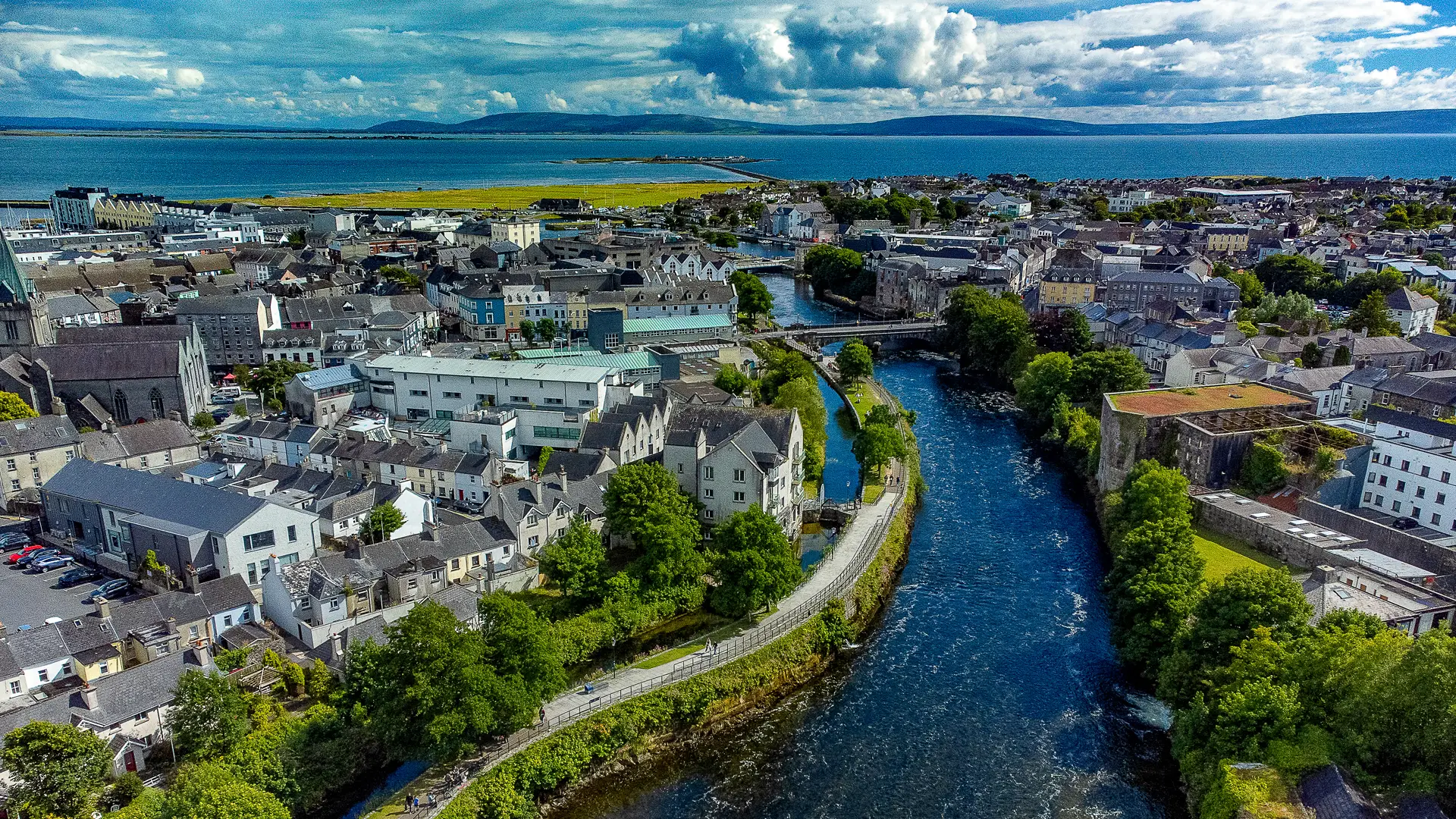
River Corrib
Flowing from Lough Corrib to Galway Bay, the River Corrib runs through the heart of the city. Although just over 6 km long, it is one of Europe’s fastest rivers and carries an immense volume of water. As the sole outlet of the Corrib–Mask catchment, it powered mills, shaped settlement patterns, and determined the location of bridges, industries, and islands. The Corrib remains central to Galway’s identity.
Canals and Mill Rivers
From the early 19th century, Galway’s waterways were adapted to meet industrial and social needs. The Distillery River and Eglinton Canal were engineered to power mills, transport goods, and provide employment during the Famine. Natural branches — including the Gaol, St Clare, Parkavera, and Madeira Rivers — were incorporated into this system, creating islands and supporting breweries, distilleries, paper mills, foundries, and sawmills.
Urban Channels
Smaller channels such as the Friar’s River, Slaughterhouse River, and Middle River were altered, culverted, or redirected over time. These waterways powered early mills and later electricity generation, forming a hidden industrial network that quietly shaped the modern city.
.
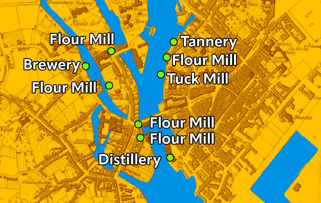

Galway Industries
Thriving Industries beside the rivers
Madeira Island
The “Madeira industrial corn mill” in Galway is primarily associated with the historical Madeira Island, an area that once housed a variety of industries, including a brewery, distillery, paper manufacturer, and saw mill, all powered by the channeled Madeira and Parkavera Rivers.
Distilleries
Nun’s Island Distillery (Persse’s Distillery), 1846
For much of the 19th century, the Persse family ran one of the most successful distilleries in Ireland. Their product became world famous. They were major contributors to the industrial life of Galway and provided much needed employment. In addition to their staff, they were also supplied by a number of artisans working in the Nuns Island area — coopers, cork manufacturers, printers, carters, case makers, etc.
In 1840, Burton Persse purchased the Nuns Island Distillery which had been owned by John Lynch and which had been producing 100,000 gallons per annum. Persse initially established a woollen mill there but when the trade in this article declined and when the lease on his Newcastle distillery ran out, he restored the works at Nuns Island to their original business and focused all of his energy on enlarging and improving the distillery.
In 1901, The Freeman’s Journal reported that Persse Whiskey could be found in ‘every portion of the habitable globe, in the principal cities and colonies, whether in America, Australia or South Africa, in all the great centres of population in the United States and in all the capitals of Europe’. It was the favourite beverage in the House of Commons.
There were a number of court cases against publicans who were diluting Persse’s Whiskey which was having a damaging effect on the distiller’s reputation. There were other factors too militating against them and sadly, in October 1910, it was announced it was in liquidation and was for sale by private tender.
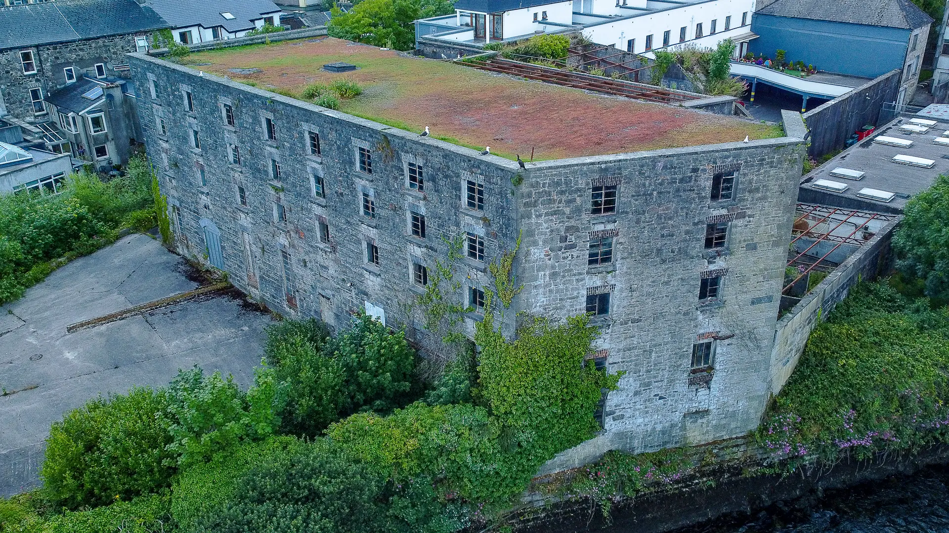
Flour Mills
Why Flour mills?
Old Galway had flour mills because they were essential for grinding locally grown wheat into flour, powered by rivers like the Corrib, serving growing populations, boosting trade, and becoming local industrial & social hubs before modern methods took over.
The Bridge Mills, one of the most iconic former flour mills in Galway, located on the banks of the River Corrib near the Westend.
Milling at the site dates back to at least the 16th century, with a large water-powered mill built around 1800 that produced corn and flour. The building later expanded to include malt and wool processing.
Mill Street Mill was built around 1800 by John O’Flaherty, a wealthy merchant and landowner who owned several properties in Galway.
The mill was once an important source of livelihood for the local community, producing flour from wheat and oats.
Today, it is a disused but well-preserved monument that showcases the industrial and architectural heritage of Galway.
Tuck Mill
On the map there is mention of a Tuck Mill, which seems to be for a specific type of wool.
The tuck mill was used in the woollen industry to improve the quality of the woven fabric by repeatedly combing it, producing a warm worsted fabric.
Beetling Mill
The purpose of the beetling mill was to consolidate the woven linen cloth and to give it a sheen.
Spinning Mill
The spinning mill spun the fibres, be they wool, linen, or cotton into thread, ready to be woven into cloth.
Scutch or Flax Mills
The scutch mill was used in the linen industry to remove the fibres from the flax stalks.
Tannery
A factory where raw animal hides and skins are processed through chemical and mechanical treatments (like soaking, liming, tanning, dyeing, and finishing) to transform them into durable, flexible, and usable leather for products such as shoes, bags, and clothing.
Lime Kiln
The Fisheries Field Kiln is a large lime kiln that was built around 1820 and is located on the grounds of the University of Galway (NUIG). A lime kiln is a structure where limestone (calcium carbonate) is heated to produce quicklime (calcium oxide), which is used for various purposes such as building, agriculture, and chemical industries. Lime kilns were common in Ireland from the 18th to the 20th century, as lime was an essential material for construction, especially for mortar, plaster, and whitewash. Lime was also used to improve the fertility of acidic soils and to neutralize harmful substances in water and waste.
Unfinished project
Just as we thought this project was finished, we came across a whole new slate of maps and interesting Heritage Stories. So, this project will be ongoing, it is too exciting just to finish, as we have much more stories to tell.
Summary
Galway City is over 900 years old, with its origins tracing back to a fort built by the Irish king Turlough O’Conor in 1124 AD, establishing it as a strategic settlement, which later grew into an important trading port under Anglo-Norman control, celebrating its medieval foundations with structures like the Spanish Arch and its distinctive street layout.
In this project Galway Atlantaquaria has created a storymap that follows the flow of the watercourses, and therefore when you walk these routes you may spot some of the sites which echoes are still there, and have a greater understanding of how they are linked to our sense of place.
Galway is a fantastic medieval and historic place to explore and learn about our history and who we are.
SOURCES
Heritage Maps Credit
‘Data from the Historic 25 inch (1897-1913) accessed through the Heritage Maps Viewer at http://www.heritagemaps.ie Jan 2026′.
‘Data from the Historic 6 Inch First Edition Colour (1829-1841) accessed through the Heritage Maps Viewer at http://www.heritagemaps.ie Jan 2026′.
https://heritage.galwaycommunityheritage.org/content/category/places
http://places.galwaylibrary.org/
https://galwaywhiskeytrail.ie/history
Nuns Island Distillery
https://en.wikipedia.org/wiki/Nun%27s_Island_Distillery
http://www.saolta.ie/about/guh-history
https://www.kennys.ie/old-galway/1216-71the-great-famine-in-galway